

Remote Sensing and InSAR Consultancy
Combining Satellite Data with
Engineering Insight

We combine expertise in civil engineering, satellite remote sensing, and GIS to deliver clear, reliable information to global stakeholders in infrastructure, mining, energy, and insurance.


Services
We Offer a Range of Services to
Meet Your Needs
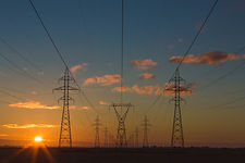
Displacement Measurement
We use InSAR techniques to measure ground displacements with millimetric accuracy in various geological environments.
Susceptibility Mapping
Geohazard susceptibility mapping for landslides and subsidence using satellite imagery and engineering expertise.
Soil Moisture Detection
We analyse satellite images to track soil moisture changes, crucial for assessing susceptibility to geohazards.
 |  |  |  |  |
|---|---|---|---|---|
 |  |
Testimonials
What Clients Say

Geofem provided InSAR displacement data and advanced numerical analysis for a large, slow-moving / marginally stable low angle slope designated for a new housing estate. Their retrospective displacement data and geotechnical insight proved invaluable in our assessment of the analytical soil parameters, the current stability of the slope and design of risk mitigation measures.
Stuart Wagstaff, Director
Soil Consultants Ltd

Geofem Ltd provided us with SAR-derived embankment settlement data from single interferograms following Lift 2, confirmed by terrestrial data. Faster than expected settlements allowed the early resumption of construction, saving time and cost.
IAN Johnson, Technical Director
JBA Consulting
I have used Geofem to carry out InSAR analysis for a legal case study in NSW, Australia. InSAR movement data over time was provided when no survey data was available over a XMAS period at a construction site. InSAR would provide valuable insights in forensic engineering to assess causes of failures and damages to infrastructure and construction, and highly recommend Geofem in this regard.
Dr.Burt Look
OAM AGTRE
Our Clients

.png)


