


Turning satellite data into engineering insight
From reactive fixes to proactive, engineering-led ground risk decisions.
Welcome to Geofem.

Turning satellite data into engineering insight
From reactive fixes to proactive, engineering-led ground risk decisions.
Welcome to Geofem.
You don’t have to make sense of complexity — Geofem does that for you.
Because we don’t just deliver satellite data or technical outputs.
We validate, interpret, and refine the data into clear insights and actionable recommendations.
The result:
Clear visibility of ground movement and change

Engineering-led understanding of what it means
Early identification of risk to your assets
Confident, data-driven decisions on where to act


Trusted globally, driven by excellence
From infrastructure to mining and energy, leading organisations work with Geofem to identify risk early, prioritise action, and protect critical assets—backed by geotechnical expertise and collaboration with partners like the European Space Agency.
Trusted globally, driven by excellence

Remote sensing & geotechnical expertise
With multi-PhD-level expertise in InSAR and geotechnics, our remote sensing specialists and geotechnical engineers work together to transform complex data into practical, reliable engineering understanding.
Remote sensing & geotechnical expertise

Clear data. Real decisions.
Every output is reviewed by our engineers and delivered with clear results, unique insights, and tailored recommendations.
Clear data. Real decisions.

A personalised approach
Every project matters. Expect responsive communication, flexibility, and a team fully invested in your success.
A personalised approach

A partner you can rely on
From reporting to consulting, we provide guidance and expertise to support confident, informed decision-making.
A partner you can rely on
WHY GEOFEM
What is happening?
Why is it happening?
What action may be needed?
Geofem enhances conventional monitoring by revealing what may otherwise go unseen.
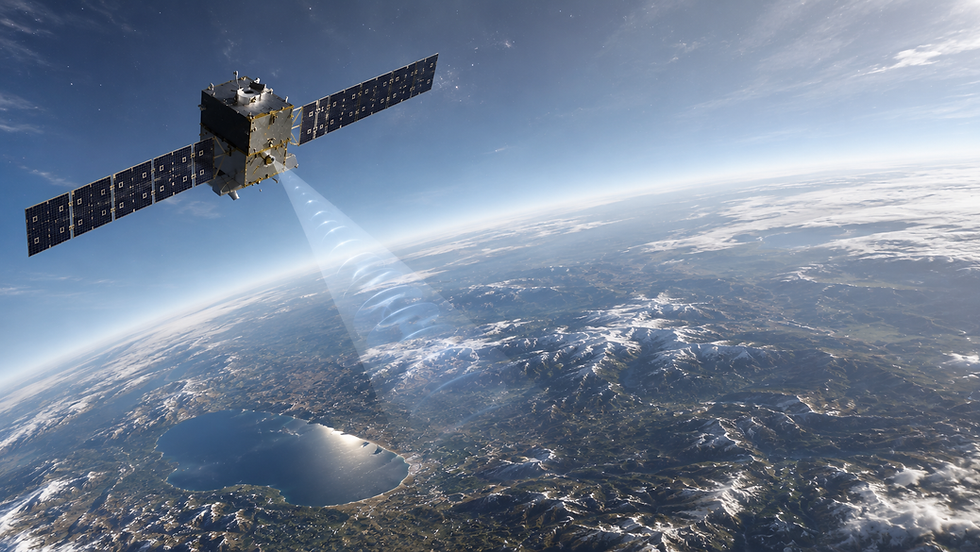
We combine satellite remote sensing with geotechnical expertise to detect early ground movement and infrastructure risk at scale.
Then we go further—translating complex data into engineering intelligence, clear interpretation, and risk-led recommendations.
So you understand the situation, the cause, and the action required.


Prioritise action with for·see decision-making tools.
See beyond your site boundaries with smarter infrastructure monitoring.
for·see turns complex satellite and InSAR data into clear priorities, helping you spot risks early, act faster, and make confident decisions.
By identifying issues before they escalate, you reduce disruption, lower costs, improve safety, and stay ahead with seamless, data-driven monitoring at scale.




How We Work
STEP 1
Initial discussion
We speak with you to understand your site, assets, or network, your objectives, and whether you are looking to investigate a specific issue or establish ongoing monitoring.
STEP 2
Define the area of interest
We confirm your exact location and scale of the area to be analysed (e.g. site, corridor, or network) and carry out a data availability and suitability check for satellite and supporting datasets.
STEP 3
Approach & proposal
We outline the recommended analysis (e.g. InSAR, soil moisture, or hazard mapping), confirm what can be delivered, and provide a clear cost and timeline.
STEP 4
Data processing & analysis
We process the satellite data to measure ground movement and other indicators, then interpret the results in the context of ground conditions, terrain, and environmental factors to identify trends and potential risks. This interpretation is supported by our geotechnical engineers.
STEP 5
Results & delivery
You receive a report with the findings, supported by maps, graphs, and time-series data. Results are also provided as GIS outputs and made available on for·see, our web-based platform for viewing, exploring, and monitoring the data.


Our Clients

"Geofem conducted a study to assess the magnitude and extent of ground movement at a challenging landslide site along one of our state highways."
Their analysis not only confirmed our initial interpretations but also provided valuable additional insight that helped further define and justify the extent of the slide mass. The work was delivered quickly and with a high level of professionalism! We really appreciated the time the team took to clearly present their methodology and findings, ensuring we fully understood the results and their implications. Communication was seamless and their support felt consistently close, responsive, and engaged throughout the remote monitoring project.
Ari Menitove,
PE Geological Engineer
Utah Department of Transportation
Memberships
.png)
%2C%20International%20Society%20.png)
.jpg)
.png)
partners with


Protect your assets with better visibility of ground risk.
Talk to our friendly, responsive team about how we combine satellite data and engineering expertise to help you act sooner and reduce risk.